Tranmere and
Clarence Plains
Land and Coast Care

Between the hills and the bay


More information
The new neighbourhood
Tony, a local resident, recalled that the local community had a sense of newness in his early years. It was gone by the time he was interviewed in 1987, seventeen years after the Housing Commission started construction in Rokeby.
His family moved to Rokeby when he was about three years old. Their house in Free Street had only just been erected and houses on the opposite side of the street were still being built. Homes in the lower, southern part of Rokeby were built while he was at Rokeby Primary School. "We used to call it 'Brick City' at the time" he recalled.
Tony was in the first cohort of students that went to Rokeby Primary School and then onto Rokeby High School. He recalled that they were building at the Primary School the whole time he was there. Work on the High School had finished by the time he was in his final year and so his year got to use the Gym, the last building to be constructed from the original plans.
Most of the photos below were taken during the 1960s and 1970s, either shortly before or soon after public housing construction commenced.
Source: A Verbal history of Rokeby in the twentieth century with an emphasis on the 1967 bushfires compiled by Viv Adnum, pp 175-190
Links to more information on other websites
Shaping the plains - Clarendon Vale and Rokeby’s Radburn Estates
Tranmere & Clarence Plains Timeline
Directions to next sign
The Life on the Bay sign is located about two kilometres along Droughty Point Road. There is a small carpark near the beach and the sign is adjacent.
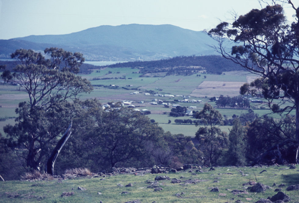

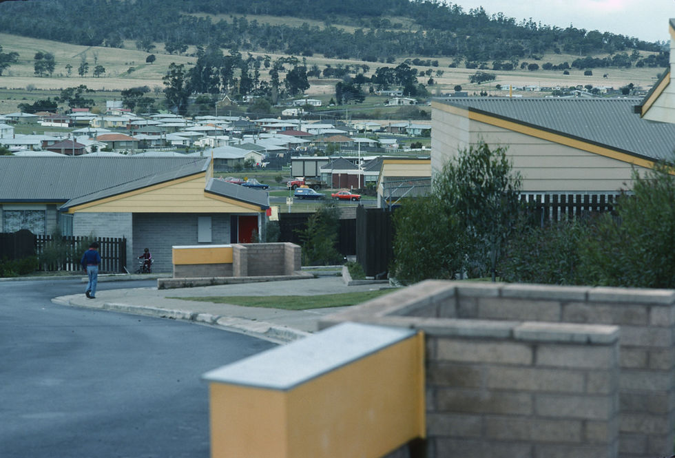
Image credits: Tasmanian Archives; NS2267-1-1644, 1641 & 1468. AA116-1-109 Image_1, NS3374-1-133 Photographer Nigel Saunders, NS3373-1-132 Photographer Margaret Bryant, NS3374-1-494 Photographer Nigel Saunders
